
(Foot)Notes on Iowa - Day 11 - Downtown Des Moines to Big Creek State Park
- Jun 20, 2021
- 5 min read
Updated: Feb 10, 2022

Embarking from the site of Second Fort Des Moines, I crossed over the river to the (north) east bank and made my way toward the Greater Des Moines Botanical Garden. Facing another day where the temperature would rise to nearly 100 degrees Fahrenheit, I started early on the longest day (in actual distance) planned for the 2021 walk across Iowa to follow the 1835 Dragoons.

The Greater Des Moines Botanical Garden operates on a 14-acre site in the downtown area, and represents the commitment of Iowans to exploring unusual flora. An idea originally brought to public consciousness immediately prior to the stock market crash preceding the Great Depression in 1929, various gardening clubs of Des Moines attempted to coalesce support around a facility showcasing a variety of plant life in Iowa's capitol. Attempts throughout the 1950s and 1960s started and stopped, before the City of Des Moines secured the current site on the bank of the Des Moines River. The domed conservatory, a notable landmark for visitors passing by on I-235, opened on December 15, 1979. Although revenue struggles threatened to close the botanical gardens in 2003, ultimately leading to the formation of a 501(3)c to manage the operation. Efforts continue to improve the gardens, including the completion of a seven-acre outdoor garden project in 2015.

Throughout Des Moines, the public infrastructure related to the maintaining the river extends beyond paved walking routes to include a variety of other interesting projects. The Birdland Marina, a city-operated river access point and boat storage area, offers a variety of amenities directly adjacent to the trail system. Recently, the city continues to focus on further developing the watercourse throughout the area into a recreational amenity. The Central Iowa Water Trails project calls for 86 individual projects across 150 miles of waterways, including five encompassing the Des Moines River as it meanders throughout downtown. Many of the projects focus on accessibility and ease of use for kayakers and fishing enthusiasts. The recreational component, when considered with the significant trail development throughout the area, showcases how infrastructure works related to the river extend well beyond flood mitigation and drinking water.

As the temperature climbed, I continued to add miles. The Neal Smith Trail offers the surreal experience of feeling surrounded by nature while passing through some of the most densely populated portions on Polk County. Aside from large packs of spandex-clad early Saturday morning bicycle enthusiasts and the largest family of Canadian geese I have ever seen, I passed through the northern part of Des Moines accompanied only by my thoughts. Some lingering derecho damage, a Forester motorhome (built in Forest City, Iowa, by an early Winnebago competitor), and an occasional bridge across the Des Moines marked my path northward. Eventually, the trees broke and I found myself beside Des Moines North High School. Reorienting based on the familiar school, the realization of how the Neal Smith Trail provides a relatively concealed throughway across the city struck me as interesting. The city developed the river, and the adjacent floodplain, in a way allowing for purposeful use while mitigating potential threats to residential and commercial interests.

For a long time before I could see them, I could hear the combined traffic of Iowa's two most important automotive arteries. Passing out of Des Moines proper and heading toward the suburbs and Saylorville beyond, I knew I would cross the under, over, or across Interstate 80/35 during the day. The reality that bridge work construction over the Des Moines at 80/35 impeded traffic on the Neal Smith Trail did not dawn on me until I faced the obstacle. Miles into the sweltering day brought me to a chain-link fence covered in 'no trespassing' signs. Always cautious about private land throughout the journey across Iowa, I decided to teleport to the other side where I arrived on a sandbar in the middle of the river. I put up the drone, and the mudswallows from under the 80/35 bridge came out to meet the potential threat in full-force (keep an eye out for the interesting footage in the Part 2, Day 3 video). Once Goldfinch1 safely landed, I continued on my way northward toward Big Creek.

Arriving at the Sycamore Access to the trail system in Johnston, I decided to take a break. Consistent bicycle traffic continued to pickup as many riders spent their late-Saturday morning packing on miles in preparation for their own upcoming journeys across Iowa. Each year thousands of Iowans (and others) participate in the Register's Annual Great Bike Ride Across Iowa (RAGBRAI) during July. The event represents the largest bike-touring event in the world. Since inception in 1973, the ride offers a unique way to traverse the state on ever-altering routes. Although different from my own journey across the state, I believe RAGBRAI offers an exceptional opportunity to see Iowa slowly. I rehydrated at the Sycamore Access, talked to a few riders, and then started back on my way north.

My steps led me to the Saylorville Dam, 214 miles north of where the Des Moines enters the Mississippi. For a moment, I considered the length of my walk to date. My focus throughout the journey focused on the next section, and realizing the half-way point of my travels existed somewhere behind me helped fuel the remaining miles. With the heat index topping 100, and fifteen miles already accomplished for the day, I trudged on toward Big Creek State Park.

Although somewhat smaller when compared with the Red Rock Dam I encountered further downstream on the Des Moines, the Saylorville Dam stand 105 feet tall and stretches nearly 7,000 feet across the Des Moines River Valley. Initially authorized to help control flooding on the Des Moines and Mississippi in 1958, constructed began in July 1965. By September 1977, the dam started helping to control the Des Moines River.
Aside from flood-mitigation, the area serves Iowans as a major recreational resource. Aside from the trails, the U.S. Army Corps of Engineers operated area hosts a variety of campgrounds, restored prairies, wooded areas, and other amenities to provide access to Iowa's outdoors. Two state parks, Jester and Big Creek, flank the area on the northwest and northeast sides.

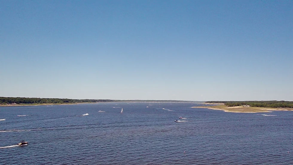
Located just north of Polk City, Big Creek State Park stands beside the 814-acre Big Creek Lake. Another legacy of flood-mitigation efforts, the lake features a large spillway and helps to ensure the safety of Polk City from rising waters. A popular fishing destination, the U.S. Army Corps of Engineers and Iowa Department of Natural Resources constructed a physical fish barrier in 2012 to help ensure the continued presence of muskie and walleye in the reservoir.

Arriving under the spillway, I noticed a large flock of pelicans slowly drifting across the water. A local woman explained how in the fall I might stop by and see flocks of immense size on the reservoir. After twenty-five miles in the scorching temperatures, I contented myself with watching the flock drift across the waters. The longest day of the 2021 walk across Iowa behind me, as well as the City of Des Moines, I turned my attention toward beautiful Boone County and the Part 2, Day 4, journey from Big Creek State Park to Ledges State Park.


Comments