


An Ioway Map of Iowa: Iowa Time Machine October 7, 1837
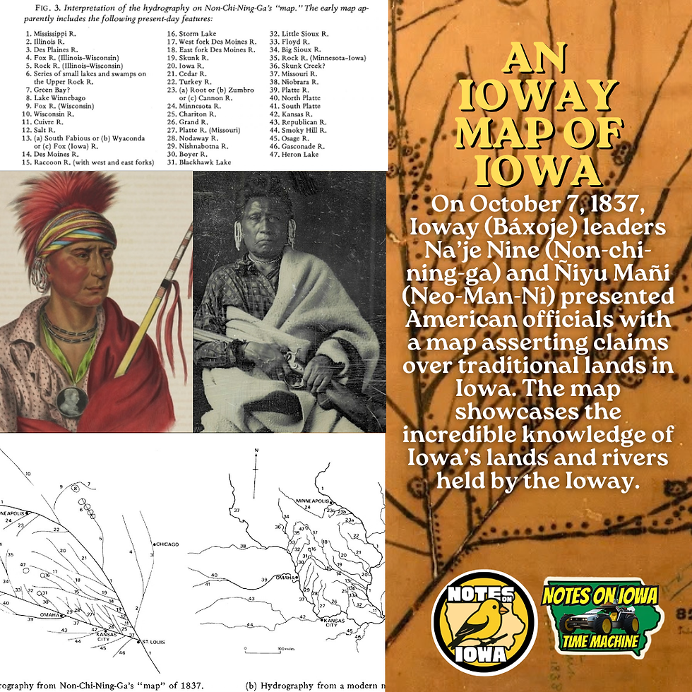
Iowa Time Machine ⏰: On October 7, 1837, Ioway (Báxoje) leaders Na’je Nine (Non-chi-ning-ga) and Ñiyu Mañi (Neo-Man-Ni) presented American officials with a map asserting claims to traditional lands in Iowa. The map showcases the Ioway's incredible knowledge of Iowa’s lands and rivers.
Initially invited to Washington, D.C., by Lewis & Clark through a letter written on the eve of the Corps of Discovery in 1804, the Ioway did not venture eastward until more than 20 years later. Na’je Nine, Mahaska's brother, served as a principal Iowa leader in the 1820s and early 1830s. Na’je Nine advocated adapting to Americanization in the early 19th century.
In 1837, Na’je Nine served on the delegation sent to an inter-tribal congress in Washington, D.C., meant to settle boundary disputes between the Ioway, Dakota, Sauk, and Meskwaki. Na'je Nine presented a detailed map of the lands and implored the Americans: “This is the route of my forefathers. It is the land we have always claimed since old times. We have the history. We have always owned this land. It is what bears our name.”
The government disregarded the Nine's detailed claims and instead set new boundaries for the Ioway, Dakota, Sauk, and Meskwaki. The new boundaries increased tensions between the Indigenous peoples by altering borderlands to create space for American settlement. #IowaHistoryDaily #IowaHistoryCalendar #IowaOTD

Comments